
From residential to large solar farms around Africa, the solar industry is rapidly growing across the continent. it is expected that the growth of Solar power use will double in the next 10 to 15 years.
With such great growth in the industry, it is crucial to efficiently streamline industry practices to help lower installation costs,inspection and labor to make moving away from traditional energy source easier.
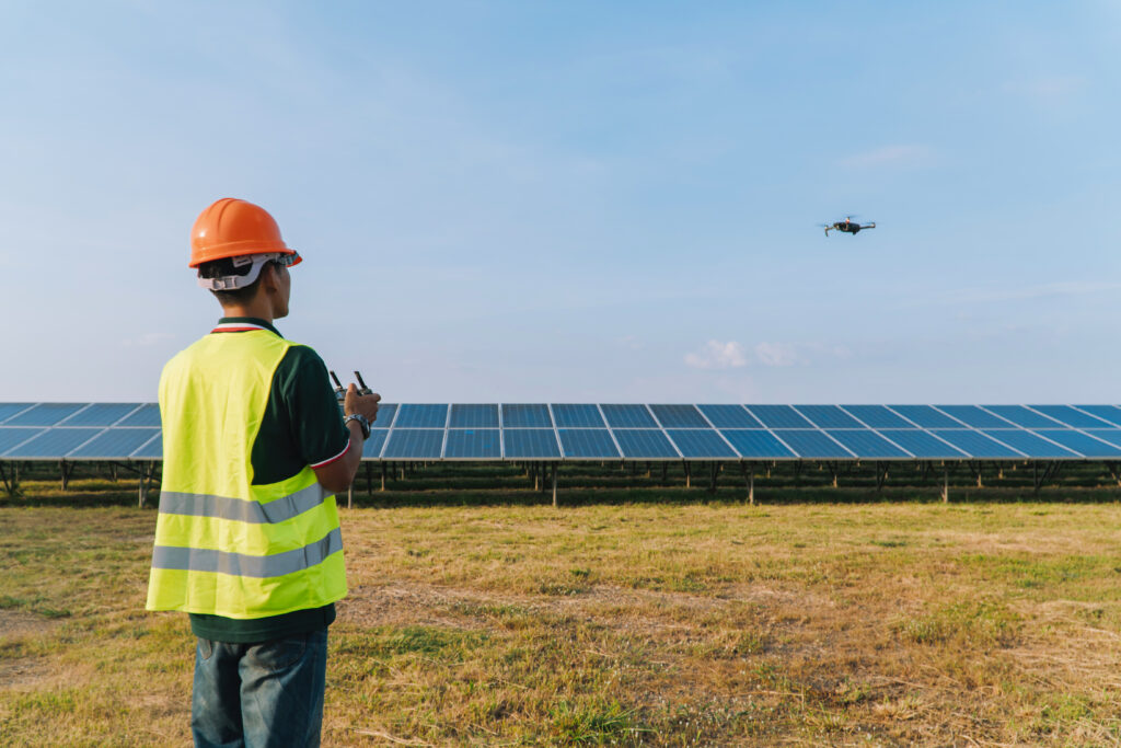
This is where the power of Drones comes into play. They can survey a construction site to find out where the best place to install panels are for best performance. Drones can also monitor a solar plant installation to ensure it stays up to standard with local regulators
The below article will focus on the top 5 ways your organization can use drones to take your solar project to the next level.
Traditional solar maintenance inspections are performed manually with handheld thermal cameras or I-V curve tracing. However, I-V curve tracing can take 2-5 hours per megawatt (MW) for a group of technicians to inspect.
This will greatly affect your man power hours and can cost you a lot of money. Some companies can decide to use sample inspection to save time, this is very risky because you might overlook faulty panels.
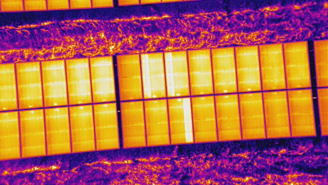
Thermal equipped drones on the other hand come in and have the ability to so approximately 1 MW in 10 Minutes, a mere fraction of the time.
During the flight, hundreds or even thousands of photos are taken and are then uploaded to specialty software that uses artificial intelligence to scan for anomalies. These defects could include string, cell, diode, and reverse polarity malfunctions among others.
Drone solar maintenance inspection reports can provide a top-down interactive map of the PV system that allows you to click on individual faults to learn where and what they are. Inspection reports can also include an as-built site drawing with the maintenance numbering scheme, so you can compare it to the final installation. Finally, solar reports also provide estimates for how much kilowatt hours (kWh) and revenue loss you’ll experience if the identified problems go unfixed. These estimates take into consideration the local cost for kWh as well as the specific model numbers and specifications of the installed panels to give you the most accurate estimation. You’ll want a diagnostic report like this so you at least have an accurate assessment of your solar plant’s health, whether or not you decide to improve it.
Drone inspections bring many benefits. For one, they reduce inspection time by eliminating the need to check solar panels one by one with a handheld device. They also eliminate the need to shut down the entire solar plant. Unlike manual I-V curve inspections, drones can inspect solar panels while they are still operating. So you don’t lose out on any revenue during that time.
Ultimately, the total amount of time and money you save through drone solar inspections makes them an obvious choice for maximizing profits.
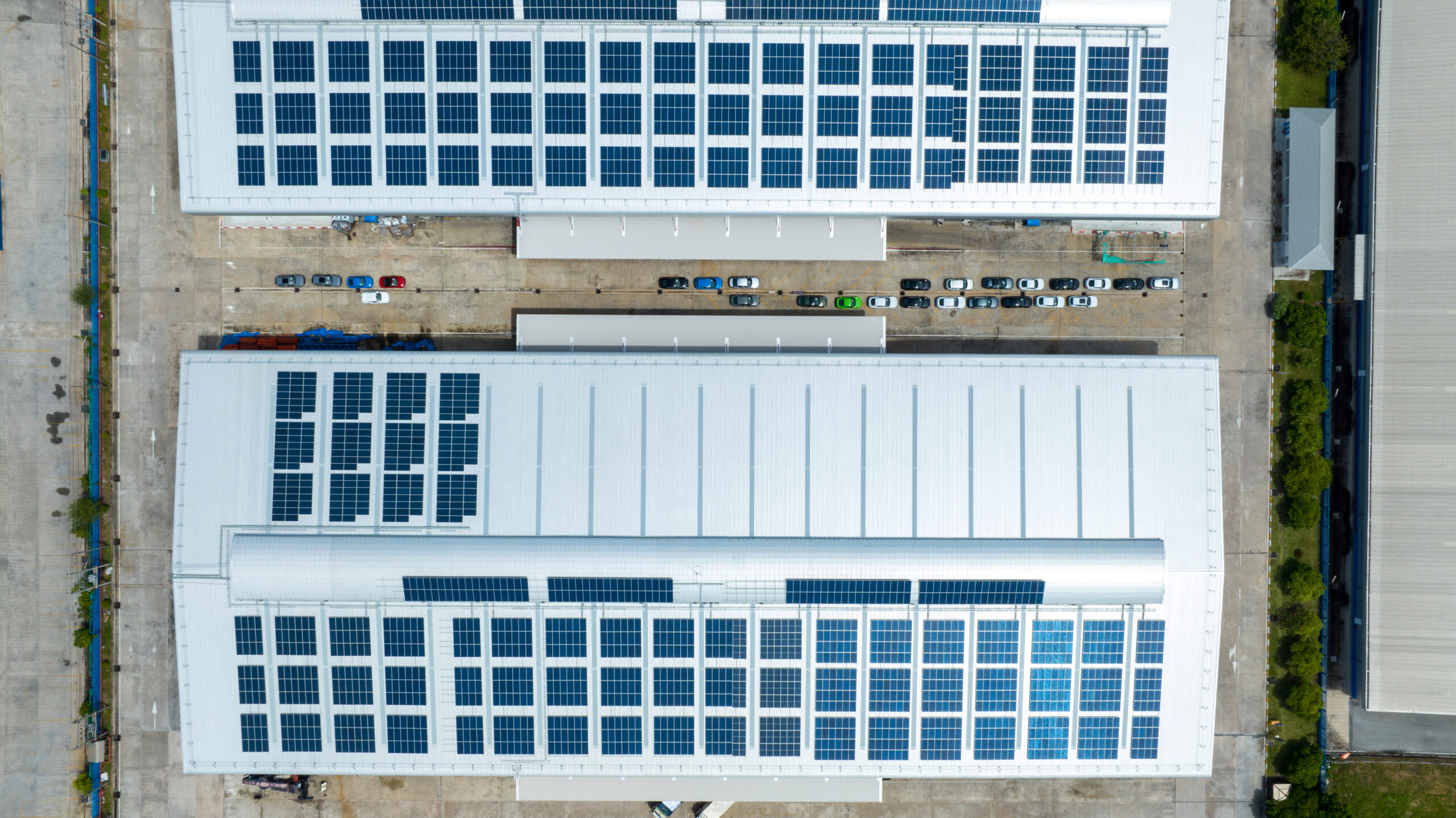
Rooftop PV installation systems require proper site planning. Traditional rooftop planning involves a lot of bottleneck processes, like obtaining necessary permits, finding recent photos of the roof, and gathering measurements of parapets, offsets, and obstructions. But drones accelerate this process by performing aerial surveys that are 75% faster than manual surveys.
The drone footage is then processed by engineering and computer-aided design (CAD) software to give you precise measurements of boundaries, obstructions, offsets, and so forth, so you know exactly where and how to build the PV system.
Drone rooftop reports produce a number of files, including orthomosaics, digital surface models, point clouds, orth scale factors, 3D Mesh Files, and AutoCAD files. Together, these deliverables give you an unprecedented amount of data to work with, which ultimately leads to a faster, safer, and more accurate rooftop site installation.
Drones inspect more roof area in less time and enable installation teams to obtain necessary permits faster. They eliminate the safety risks of manual rooftop visits by not putting workers at dangerous heights and they prevent outdated or incorrect measurements from turning into costly mistakes.
Drones can be great tool for monitoring progress at regular intervals when construction of a PV system is underway.They can collect aerial imagery on a weekly or even daily basis to track changes over time and document milestones. This way, the construction team can stay on top of the schedule and make necessary adjustments.
At the same time, drone reporting software can deliver numbers and percentages on the current state of construction to all managers and stakeholders. Even if they are not on-site, they can get real-time progress reporting that gets everyone on the same page.
Solar progress reports can also help identify construction issues in advance. For example, drone images can be overlaid with as-built drawing plans. If there are any discrepancies, you can correct them before they turn into bottlenecks down the line. This way, you minimize delays and ensure adherence to the project schedule. Plus, PV construction involves a lot of workers and heavy equipment, so drone progress reporting can help foresee and prevent potential safety issues.
In the long run, drone construction progress reporting benefits managers, clients, investors, and engineers. Teams stay on schedule, workers are safer, and asset owners and stakeholders maximize their returns on investment
Before construction begins on a ground mounted solar system, it’s important to understand the condition of the proposed site. Drones can survey the topography of a site to help development and engineering teams assess whether they need to do any earthwork before building. Drones are able to measure and assess the ground to produce contour maps, diagrams with exact volume measurements, orthomosaics, digital surface models, and more.
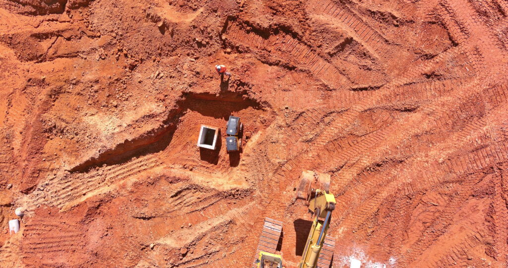
Aerial topographic surveys have many benefits. They allow you to position your solar panels where they’ll get maximum sunlight and show potential runoff and cut and fill areas. Topographic drone surveys also give you 3D data for future assessments and simulations. This data is great for keeping a documented record of the site.
Drones can also help in commissioning and asset transfers. During this time, it’s important to verify that the new solar plant is healthy and up to standards before closeout. Drones assist with this by checking that the installation is complete, safe, and compliant with all safety requirements
Drone commissioning inspections can also help you locate installation issues like defective modules, string outages, inverter and combiner anomalies, and more. This way, you can claim them under warranty while in the warranty window.
Commissioning inspections also provide documentation for future inspections, so that operations and maintenance technicians have a baseline to go by. That way, they have historical data to assess which solar panels require the most attention.
Finally, commissioning inspections assure owners that their PV system was installed properly and that it is operating at peak efficiency. They can rest assured knowing their new solar plant will start producing maximum energy
Take advantage of the Drone advanced technology and let our trained pilots help you take you Solar operations to the next level from site development surveys, commissioning, and routine drone inspections for rooftop and ground-mounted PV systems. Schedule a free one-on-one meeting with one of our team members today